Tateyama Kurobe Alpine Route: A Spectacle-Studded Journey Across the North Japan Alps
This alpine sightseeing route runs for roughly 90 kilometers eastward through the North Japan Alps, a mountain range of such heights that it is dubbed the “Roof of Japan.” The route passes through a succession of breathtaking scenes as it winds upwards through the dramatically varying topography of Mt. Tateyama’s foothills. In under an hour, a combination of transportation methods will take you from a primeval forest with trees aged over a thousand years, to vast wetlands where rare alpine plants grow wildly.
One of the highlights of the Alpine Route is the iconic “Snow Walls” of Murodo. As transient as it is spectacular, a steep-walled path is carved through the snow each spring. These walls of snow tower high above the path, which opens in April, and they typically last well into June. Certain sections of the Alpine Route can be traveled by ropeway or cable car, allowing for some breathtaking elevated views of the mountain scenery.
The Alpine Route ends in Ogizawa, Nagano Prefecture, after passing through the foothills of Mt. Akazawa which roughly mark the border between Toyama and Nagano Prefectures. The majority of the Alpine Route’s sights are on the Toyama side of the border. Moreover, Toyama makes a highly convenient point at which to begin the journey: Tateyama Station, where the Alpine Route begins, is around 75 minutes from Toyama City by train.
The iconic “Snow Walls” of Murodo
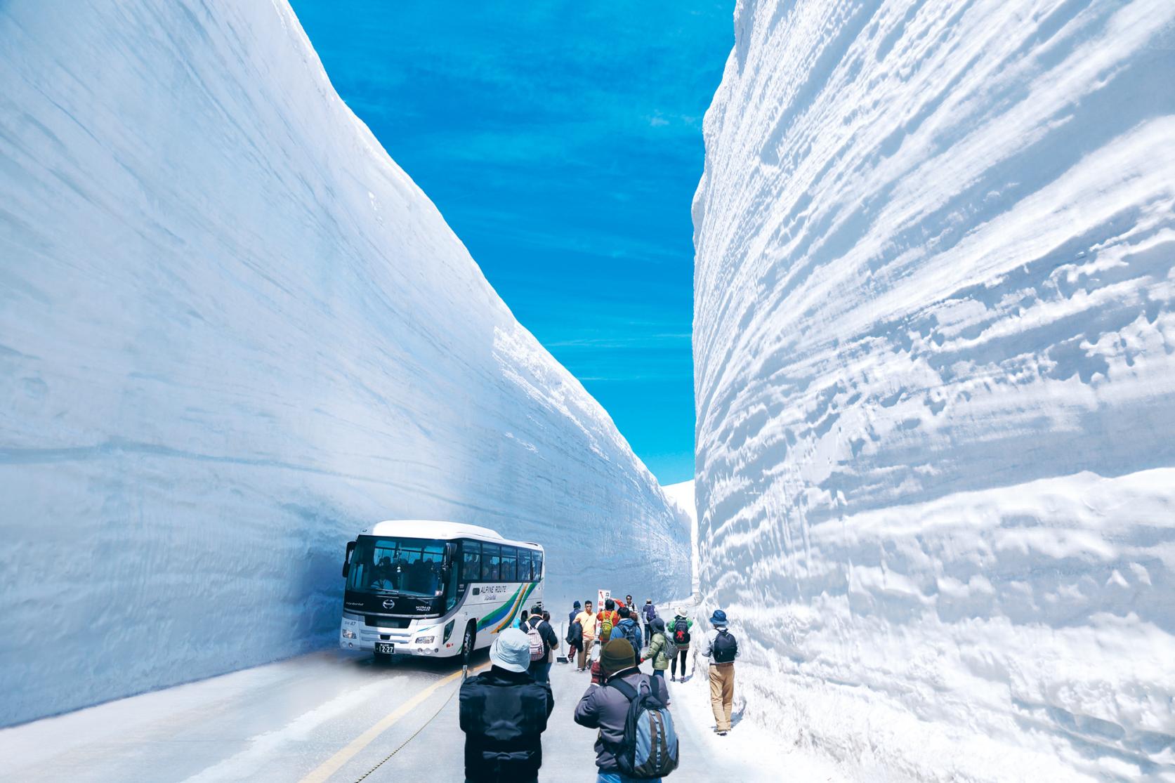
Buses carry passengers through Murodo’s iconic snow corridor and stop for visitors to alight, walk, and take photos beside the immense snow banks which can reach heights of up to 20 meters. The striking contrast between these white walls and the often brilliant blue spring sky makes the scene one of Toyama’s most iconic. The snow corridor traverses one of the highest sections of the Alpine Route, a mere 500 meters below the 3,015-meter summit of Mt. Tateyama. The road is just wide enough for vehicles and is cleared each spring, typically open to visitors to walk through from mid-April until late June. Towards the end of this period the walls diminish in height as the temperature rises. The Tateyama Highland Bus will take you directly to the snow corridor from Bijodaira.
Shomyo Falls, Japan’s tallest waterfall
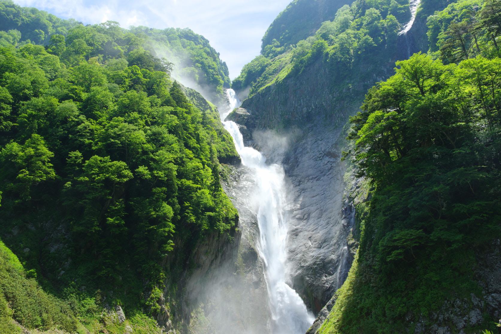
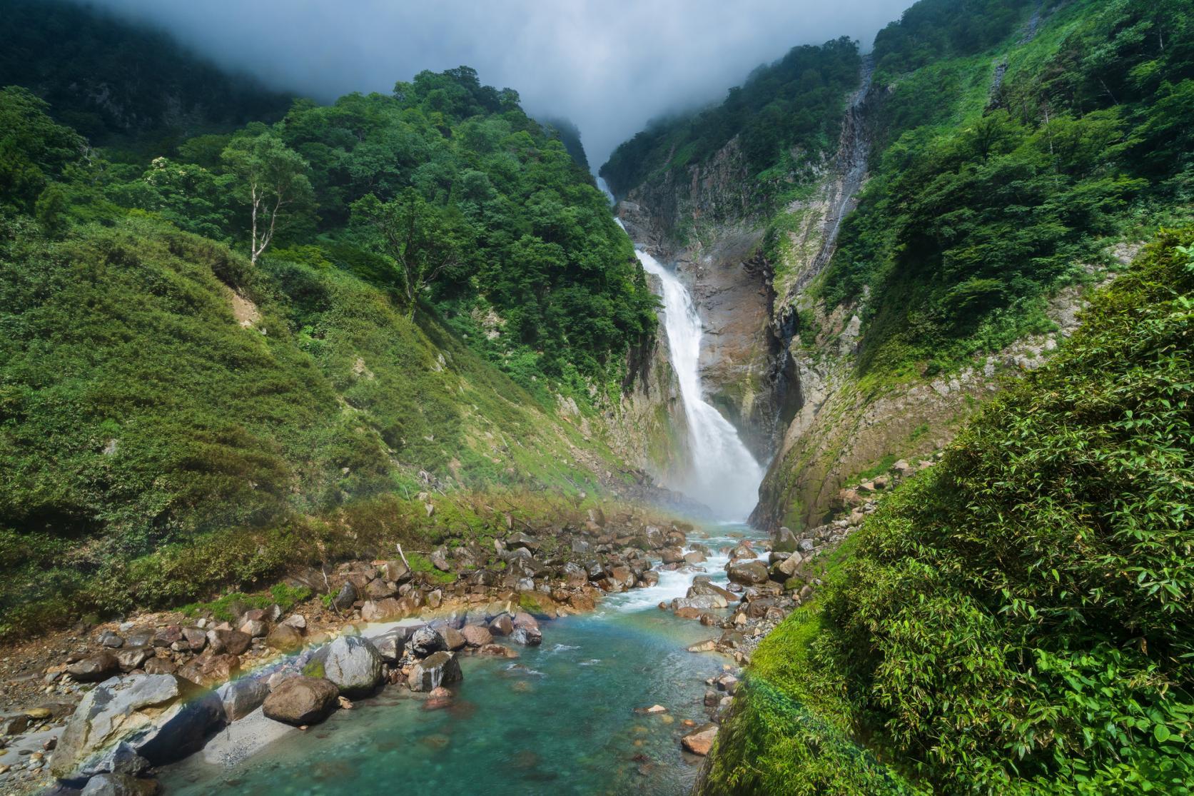
Shomyo Falls, some 350 meters high, is the tallest waterfall in Japan. Here, water from the Tateyama mountains sends spray flying as it thunders down a rugged cliff face. In spring, when the volume and flow of the water is at its peak, additional cascades sometimes form. These are commonly referred to as the Hannoki and Somen Falls. Lucky visitors may encounter the trio of falls, or even rainbows which sometimes appear among the spray.
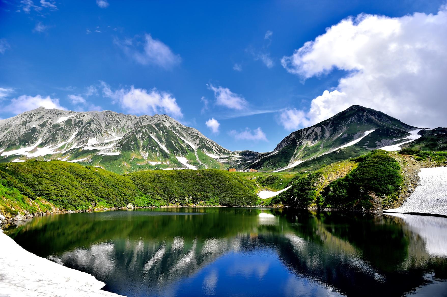
Mikurigaike, a picturesque volcanic pond
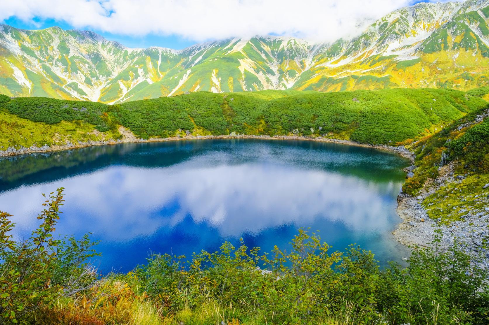
Mikurigaike is the largest of the volcanic ponds dotted around Murodo, and also one of its highest at an altitude of 2,405 meters. It freezes over and is generally covered with snow until June. When the snow and ice thaw, the pond appears a very pure blue. With no wind, the still surface reflects the surrounding mountains with mirror-like clarity. The pond is typically free of snow and ice between July and October.
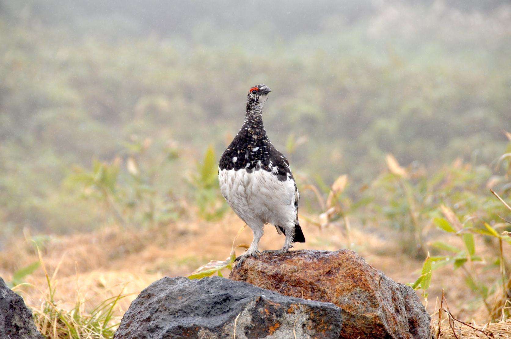
Paths around Mikurigaike give visitors the opportunity to enjoy alpine vegetation, which includes rare wildflowers, and creeping pine trees that are home to the rock ptarmigan. Keep an eye out for this plump bird, a protected species and an official symbol of Toyama Prefecture.
The ancient forest of Bijodaira
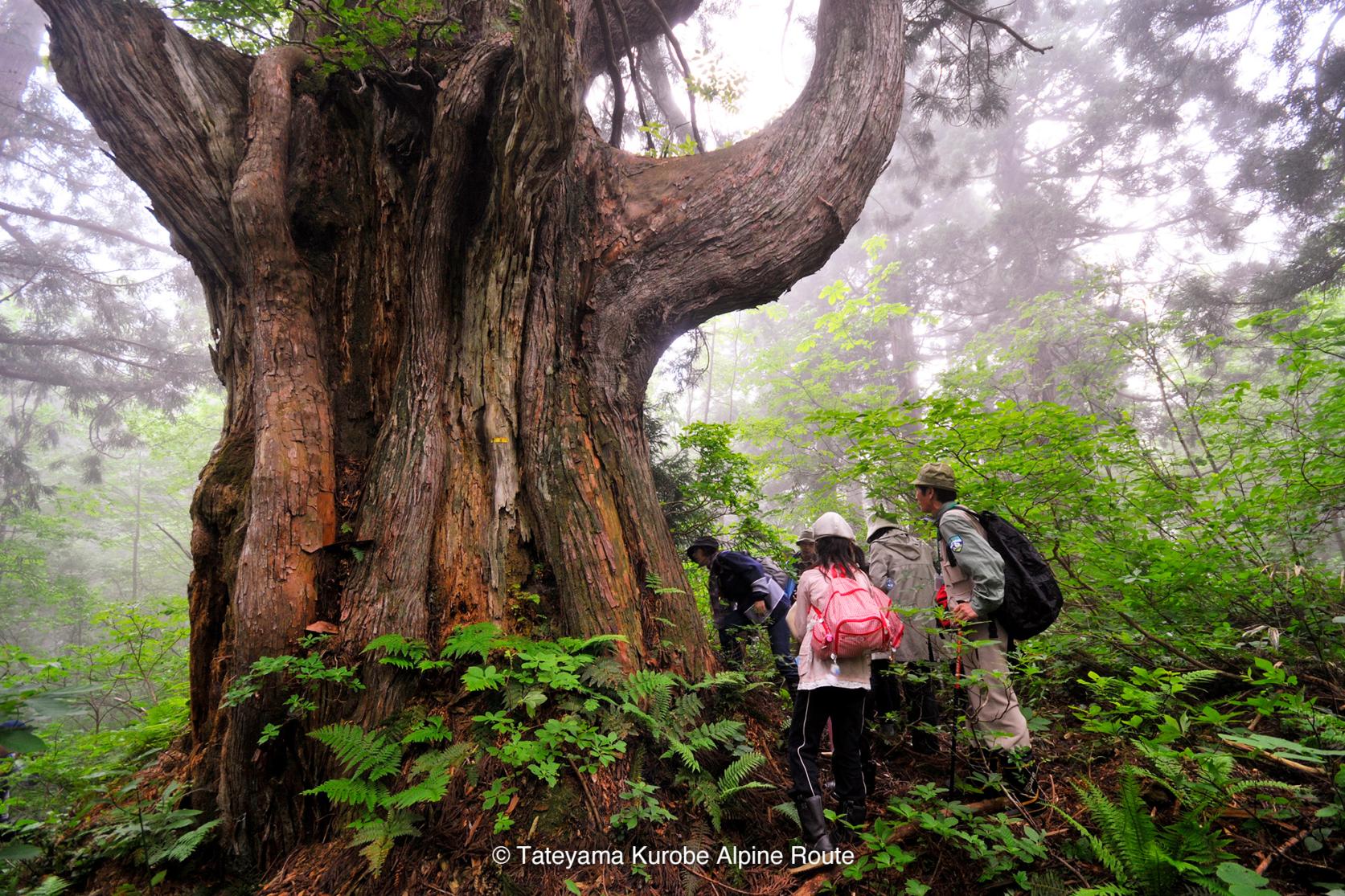
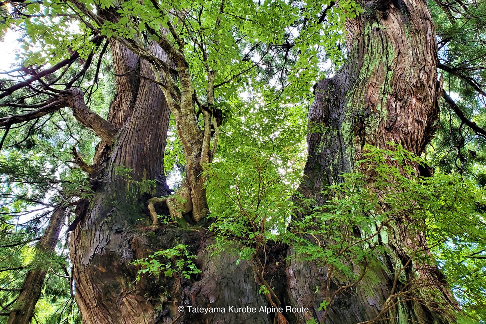
A primeval forest covers Bijodaira, on the western slopes of Mt. Tateyama. Some of the giant “Tateyama Cedar” trees are over 1,000 years old. The gnarled branches of these “elder giants” of the forest are a testament to their age, and some of the cedars feature naturally hollowed-out trunks that you can step inside of. Some of the oldest trees have trunks up to 6 meters wide.
The forest is made up of many other tree species including beech trees, some of which are between 200 and 300 years old. It is perfect for “forest bathing” or birdwatching. Over 60 bird species inhabit the forest, including woodpeckers and pheasants. May and June are the peak months for birdwatching. For stunning views over the forest, head to the observation platform, on top of Bijodaira cable car station.
Midagahara, a rich wetland ecosystem among the clouds
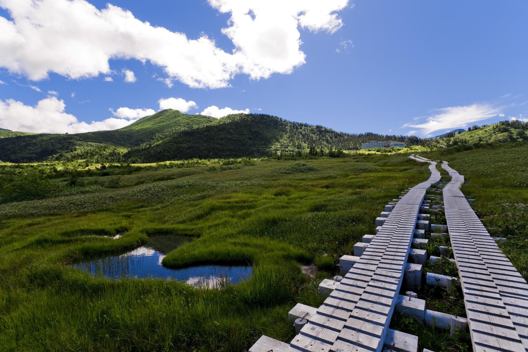
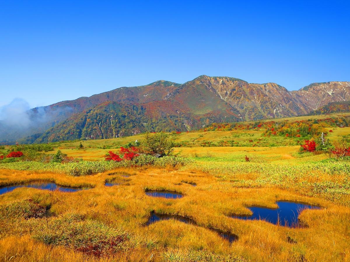
Almost 3,000 small ponds dot the surface of the Midagahara plateau, reflecting the beautiful Tateyama alpine scenery in clear weather. The rich ecosystem of Midagahara is recognized by the Ramsar Convention as a Wetland of International Importance.
Midagahara is a lava plateau, formed over millennia by volcanic activity. In the present age it boasts 80,000 sq. meters of marshland where a diversity of seasonal alpine plant life thrives.
Midagahara is especially spectacular in autumn, when the wetland foliage gradually takes on burnished hues of yellow, orange, and red. Weather conditions at certain times of year—primarily between April and November, and especially in June—create a “sea of clouds” phenomenon. This occurs when clouds hang low on the mountainside, giving the feeling you are among or above the clouds. The plateau ranges from between 1,600 and 2,100 meters in elevation.
Getting there and practicalities
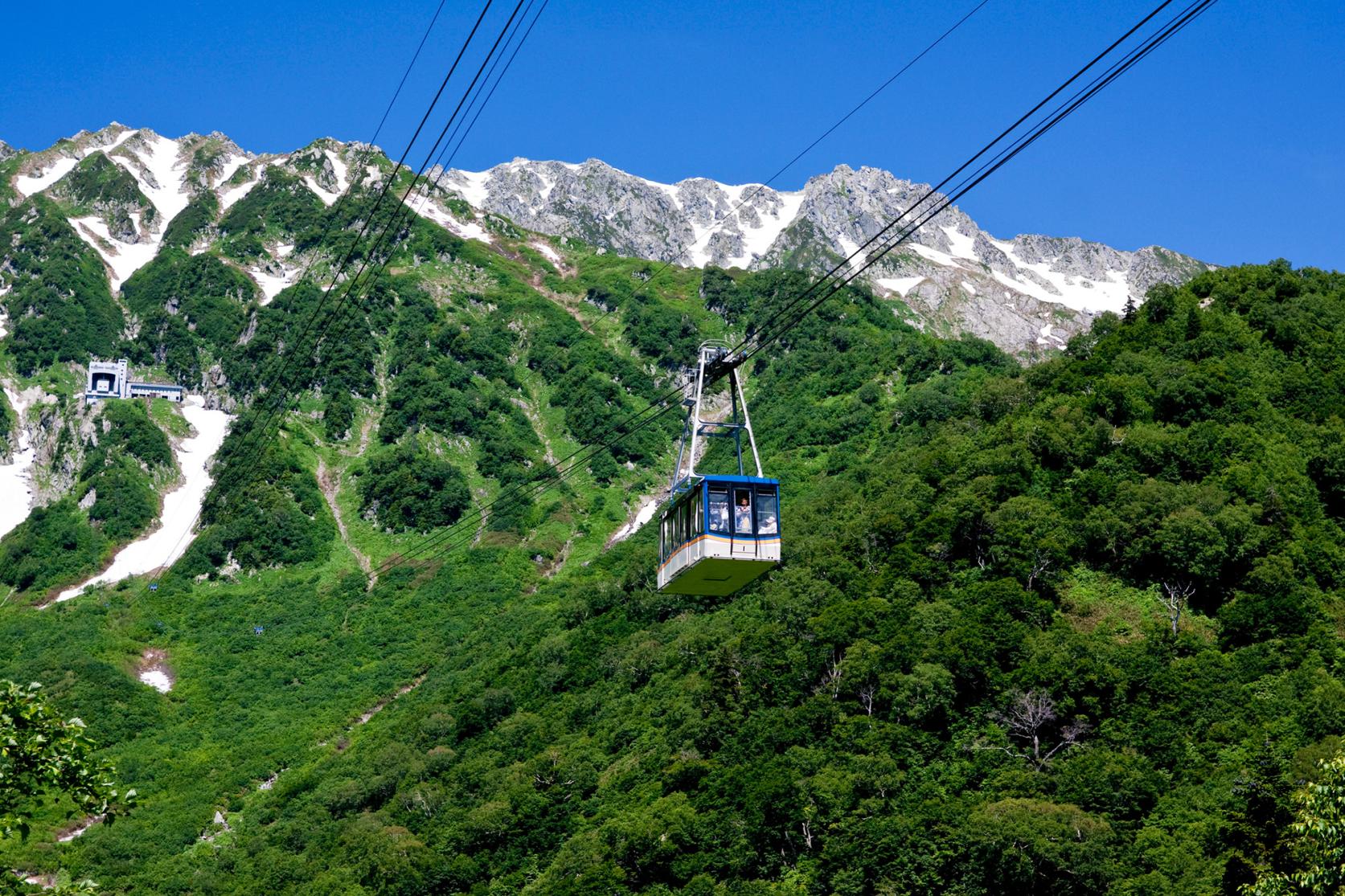
The journey along the Tateyama Kurobe Alpine Route is undertaken via a succession of public transport services as the trip is not possible by private vehicle. The alpine excursion comprises trains, buses, cable cars, and ropeways.
From the Toyama Prefecture side, the Alpine Route begins at Tateyama Station. Trains to Tateyama Station from Dentetsu Toyama Station, take around 1 hour and 15 minutes. By car, the journey from central Toyama City to Tateyama Station takes around 50 minutes.
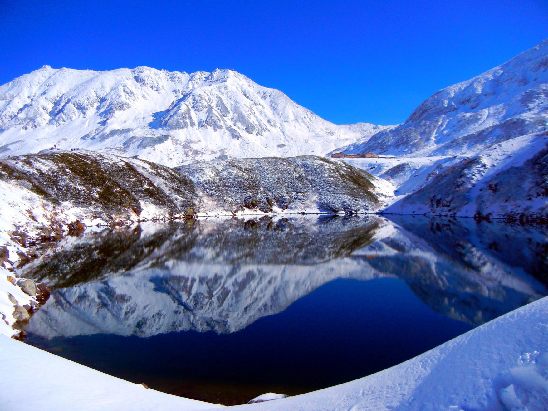
The Tateyama Kurobe Alpine Route is typically open from mid-April through to late November.
You Might Also Like
-
Open for 100 years! Get Close to the Charms of Unazuki Onsen
-

In Search of Toyama's Best, Most Delicious Seafood? Head to the Fishing Port!
-

Take the Hokuriku Shinkansen and Go On a Trip to Eat All Kinds of Exquisite Crabs!
-
Toyama Black Ramen and Where to Eat It
-

Visit Takaoka: The Hometown of One of Japan's Renowned Manga Artists!
-
Discover Toyama
-
A Tour on the JR Takayama Line Limited Express "Hida": Comparing Local Sakes of Toyama and Takayama
-

The Best Kaisendon Seafood Bowls Around Toyama Bay
-
At Toyama’s Hot Springs, Let Famous Hot Springs and Spectacular Views Soothe You, and Bounties from the Mountains and the Sea Satiate You
-

Explore Unazuki Onsen: Ride a famous trolley train and bask in the warmth of Japan's famous hot springs! (Kurobe City, Toyama Prefecture)
-
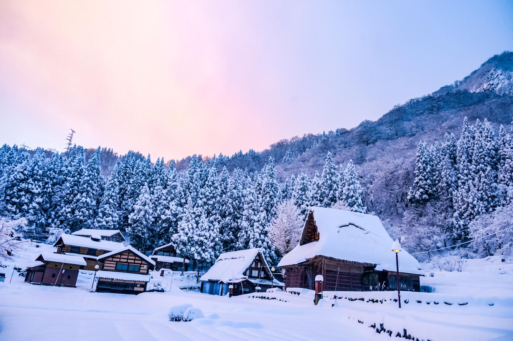
Visiting Toyama in Winter
-
Touring “Inami,” the Town of Wood Carving
-

"World Heritage Bus," the Tourist Bus That Tours World Heritage Sites
-
Kurobe Gorge is an Unexplored Region That Can Only be Reached by Trolley Train!
-

【Toyama Gourmet Deep Dive】 Tuck into local delicacies in tasty Toyama!
-
A One-day Walking Tour of Himi
-
Enjoy a scenic stroll from Takaoka Station! Tour the historic city of Takaoka
-

Savor the Ocean’s Finest: A Sushi Tour Through Toyama City
-
A Two-Day Immersive Stay in Gokayama: Where Culture, Craft, and Cuisine Endure
-
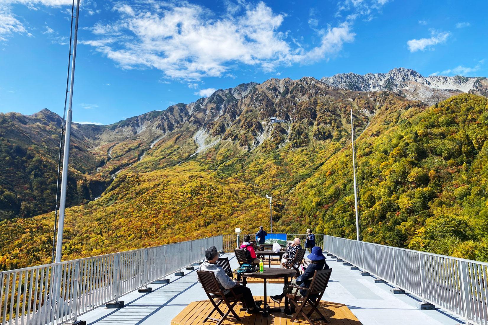
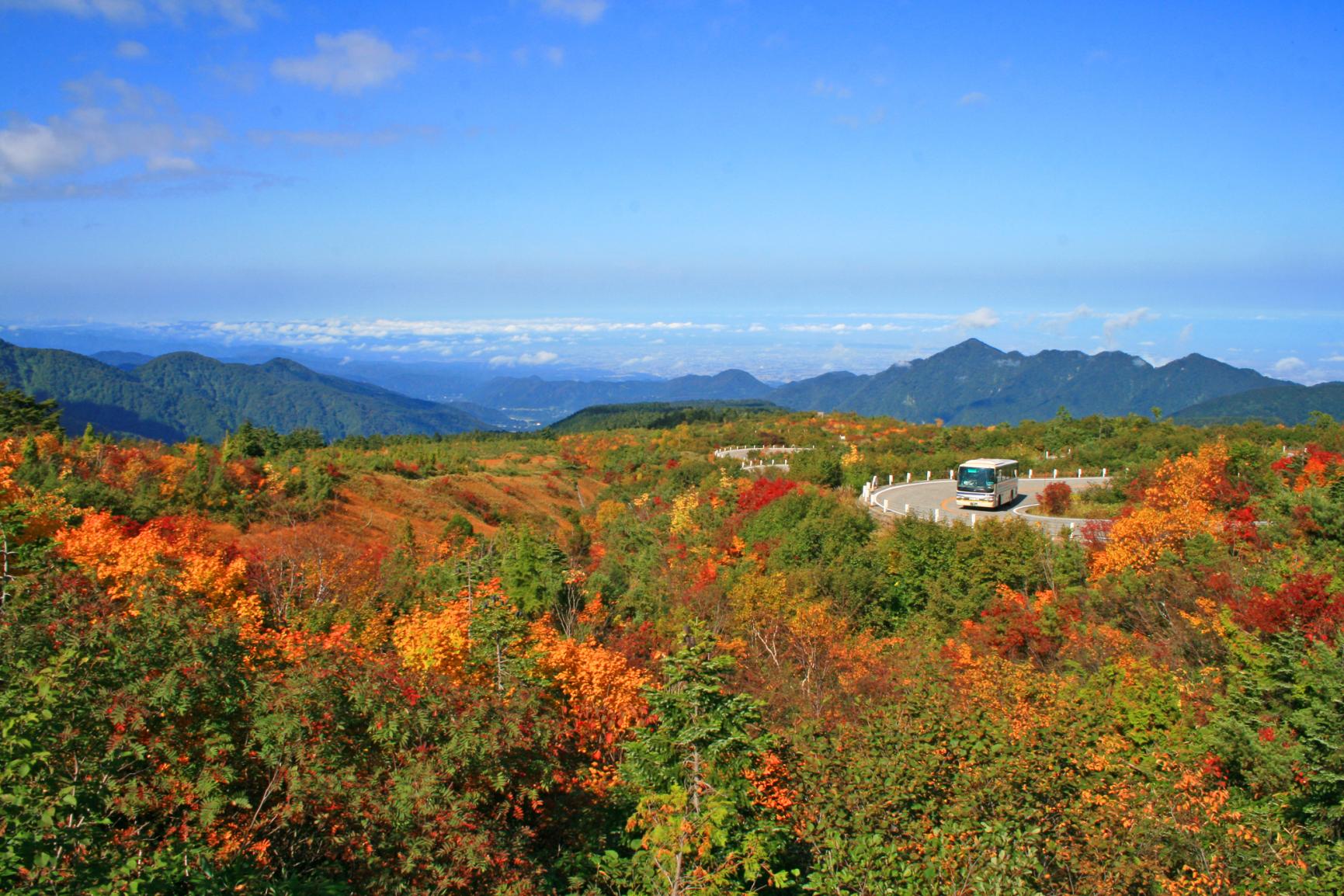
Recommended autumn foliage spot along the Tateyama Kurobe Alpine Route!